7.4 km (4.6 Miles)
143 Meters elevation gain
This is a walk through woodlands and along the open fields to the South-East of Lambourn.
Please follow the Countryside Code to keep you, your dog, farm animals and the countryside safe. Respect other people, Protect the natural environment, Enjoy the outdoors.
For dog walkers there is special advice available from Countryside Online.
If you have any hints or comments regarding this walk please add a comment using the form at the end of this page.
The Walk:
Start at the market square and make your way along the high street. Just after the Co-Op turn left. The building to your left is Valentine’s Bar which is the old fire station where the Lambourn Fire Brigade was based.
Follow the alley along, past a car parking area on your right and continue to the left of The Lambourn Centre.
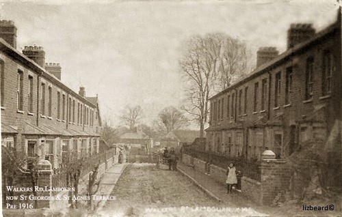
You will walk through St George’s and St Agnes Terrace. These houses were built in the 19th Century for the workers of the Lambourn Railway.
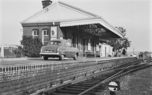
When you get to Station Road turn right. Directly ahead of you is Old Station Yard, which is where the Lambourn railway station used to be.
Turn left into Bockhampton Road.
Opposite the Lambourn Surgery turn right and proceed along the road and up the steps at the end onto a footpath.
Follow the footpath between the fences and then, having crossed a style, across the open field.
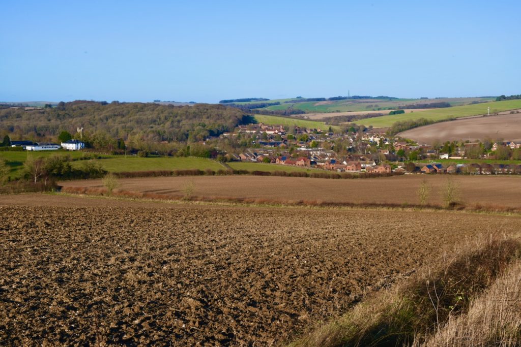
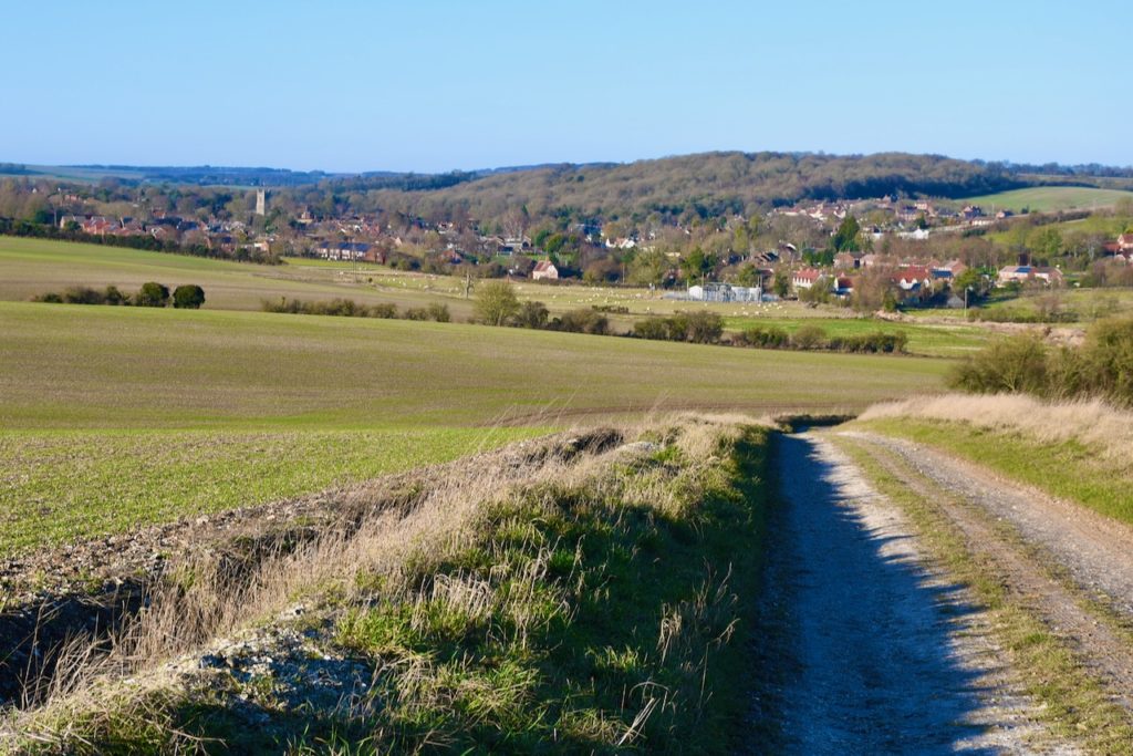
Turn left onto a track and then, after 40 meters, turn right onto a footpath. After about 300 meters you have a great view of Lambourn nestling in the valley below you.
Continue along the footpath which turns into a track and then back into a narrow footpath through woods.
When you reach a gate on your left turn right and continue on the path through the woods. At the right time of years you will see carpets of bluebells here.
The footpath emerges on the edge of a field, continue left until you see a wide road. This was part of the runway system of the old WW2 Membury Airfield. Turn left along the road and continue straight where the road curves to the right.
Take the path on your left across the field and into the woods.
Continue through the woods until you come to a paved track. Turn left.
On your left is a dew pond. These ponds are clay lined have no spring and fill from the dew and moisture which collects in the mornings.
Continue past the cottage and take the track straight ahead of you through the woods.
Continue up the hill. When you reach the crest of the hill you have another lovely view of the village.
Continue down the hill and turn left into the field just before the pumping station which is on your left.
When you reach the road turn right and then, at the main road turn left.
Walk along the lower road and footpath which the turns into a pavement along Newbury Road back towards the centre of the village.