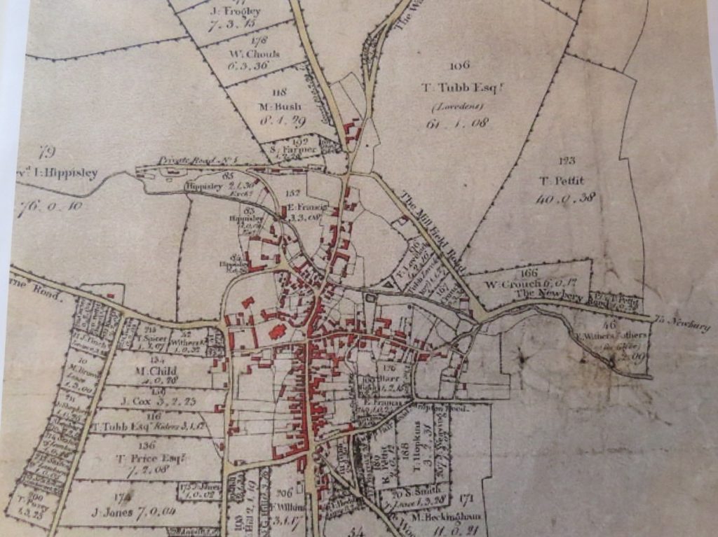
This map is from 1806 and show Lambourn with buildings marked in red. How accurate it is, I don’t know, but I think it’s not far off. It takes some studying, as the wording is small and faint. You will see that the Mill Lane that we know today, is called Mill Field Road , while Gas House Hill, or Sheepdrove Road was called The Wantage Road. The ‘Alley’ as it was known years ago, that runs from the top of the High Street up to near the school, was called “The Woodlands Road”. From the top of the High Street, Crowle Road, as we know it, is not named, but shows the cottages that were there at the end where the Presbytery is now. You will notice that there are no houses along the Baydon Road on the left or right towards Baydon. Delamere House was some cottages, until J.F Peace converted them into Delamere and some stables in 1896.
What you will see are lots of plots of land, owned by various people, mainly farmers; M. Child for instance, where Child Street estate comes from. Henry Hippisley had a lot of ground, as did T. Tubb, as in Tubb’s Farm Close. It is noticeable, that no roads or estates are named after Henry Hippisley. Most likely, due to the poor reputation he achieved in his lifetime!
Mick Dowdeswell, November 2019