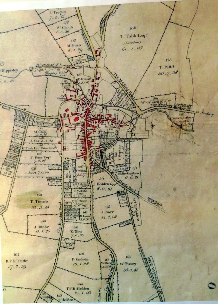
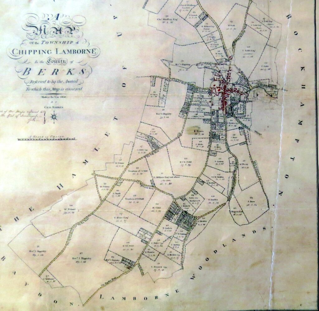
For those who have not seen this before, here are a couple of shots of the same map of ‘Chipping Lamborne’ that was drawn up in 1805. You see that the main roads were the Hungerford Road, The Baydon Road, The Newbery Road (note the spelling) and I can’t see the Oxford or Wantage Road as it’s not marked. Interestingly, the lane from the top of the High Street that goes up to towards the school and is overgrown these days, was known in a derogative way as ‘S**t Alley in the 30s, but was a thoroughfare to the Woodlands over many years. Being 1805, you will notice that the house on the map in Lambourn Place as we know it, will be the original mansion of the Lord Essex family and not the one that Henry Hippisley built in place of it in 1847. There is no Stork House, as that was built in 1855 and Delamere along the Baydon Road was converted from a cottage into the house we know today in 1896. OK, they are probably not totally accurate, but won’t be far off. The fields are shown who they are owned by and the acreage.
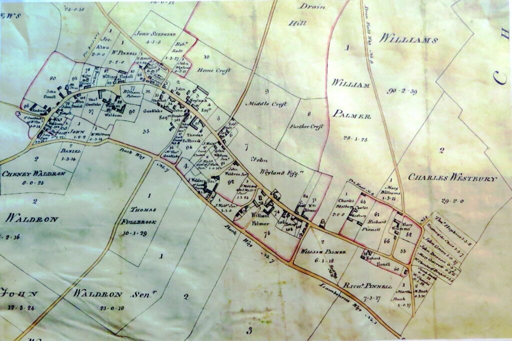
The map above is of Upper Lambourn. The lane that goes up from the Upper Lambourn Road, shown on the sign Post now as Uplands Lane Downs, or as locals know it, Winter’s Lane, is shown as Drain Field Way. I’m sure that those of you who have not seen these before will enjoy zooming in and around on these and realise the differences that are of today.
Mick Dowdeswell